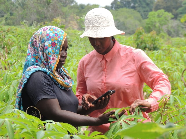
Developed by researchers from Penn State University, smartphone application program PlantVillage utilises satellite data to enable cassava and maize farmers from Western Kenya to scan and analyse diseases affecting their crops and take immediate, proper remedy actions.
According to research by a team of scientists from Masinde Muliro University of Science and Technology, Western Kenya is one of the food baskets of Kenya with crops such as maize and cassava among others being the main foods crops grown in the region.
However, the yields of these crops have remained far much below the world averages mainly due to pests and disease.
Therefore in order to develop sustainable disease management strategies, proper identification and diagnosis of crop diseases is important.
RELATED ARTICLE: Mobile application that can monitor fish pond condition launched
PlantVillage comes in handy by using artificial intelligence and satellite data to effectively inform even the smallholder farmers on the danger approaching and be able to make the best decision on how to approach it.
All a farmer needs to do is point a smartphone with the app at a diseased plant, and artificial intelligence will analyze the leaves and tell out exactly what has gone awry so that the farmer can appropriately treat the problem.
“If the plant is not doing well, then the farmer has to do something very different from what has been done before, either apply a pesticide, plant a different crop, or start irrigating,” said David Hughes, Penn State biologist, and the app developer.
RELATED ARTICLE: KALRO launches 14 more mobile applications for different crops production
The satellite data also reaches years into the past, so the farmers can see how well their plants are performing historically. On top of that, they can compare their performance with their neighbors. Meaning, maybe it’s not a rainfall problem but a pest problem that’s holding their crops back.
The researchers have been testing the new system in Western Kenya, handing out phones to ‘lead’ farmers, who travel around the community bringing insight to their neighbors.
“We’re able to tell them they have a problem, and with the AI assistant go into the field and see if that problem is a disease that’s causing a decrease in the yield or it’s actually drought,” Hughes says
RELATED ARTICLE: The latest mobile application for your farm management
With this satellite data, though, farmers can react before it’s too late.
In addition to the detective work, the app is gaining new powers thanks to eyes in the sky. Using free satellite data from the UN, PlantVillage can monitor biomass on a plot of land, giving small-scale farmers insight into how their crops are developing.