NGO launches app to help pastoralists locate water and grazing areas
3 min read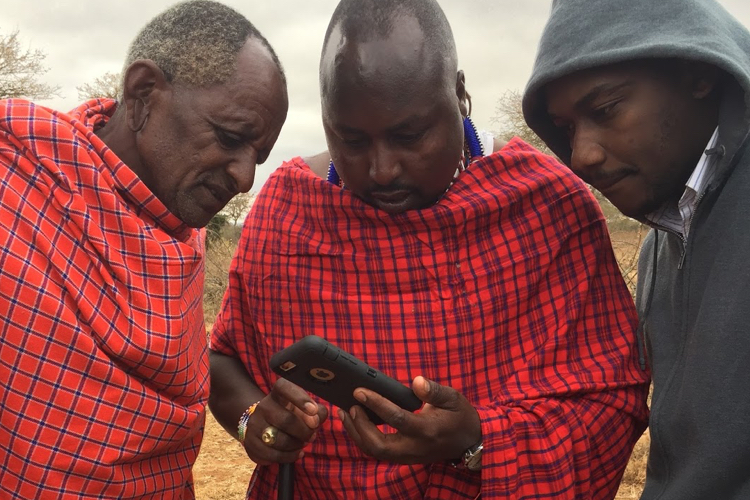
Farmers in arid and semi-arid regions in Kenya can now locate water and grazing areas thanks to a new app by Project Concern International (PCI) that displays information by the use of satellite. This will enable farmers save a third of their herd lost during dry seasons according to research.
A report by PCI reveals that pastoralists lose a third of their herd due to limited vegetation during the dry seasons. This is attributed to use of traditional methods in search of pasture such as scouting, word of mouth and indigenous knowledge that have inherent limitations and increasing unreliability due to climate shocks and land use changes.
The Afroscout app will offer pastoralists localized digital content eliminating the need for paper maps and creating long-term sustainability. In this, they will be able to make better informed decisions on where and when to migrate herds for grazing in order to reduce potential livestock loss and mitigate the effects of climate change.
Related content:
WhatsApp group help farmers access farming Information
App alerts buyers of prospected harvest
It will enable farmers check the vegetation conditions in a map of traditional grazing areas with up to date satellite information. It also displays permanent and temporary surface water variation for easy access to water sources for the animals.
The app will further help pastoralists manage conflicts such as cattle rustling through sharing of alerts and warnings on impending attacks. This also includes predator and animal disease alerts which aid farmers through tracking of livestock predators and real time alerts on diseases that affect certain regions respectively.
Pastoralists browsing for grazing areas with the afriscout app/PHOTO COURTESY
In a recent interview with local media stations, Brian Wandera, the National Program Manager, Afriscout Kenya said that the app was piloted in three African countries (Kenya, Ethiopia and Tanzania) with 29 mapped areas covering 130,676 kilometers squares and 513,149 map users. It has proved to be highly useful for pastoralists reducing mortality for herds by half, saving time in search for pasture, as well as improving collective pasture management.
In its pilot phase in Kenya, 78 per cent used maps on the app for migration decision making, 52 per cent considered the maps their most important resource while there was a 48 per cent decline in herd mortality resulting in savings of over $5m.
The app, which was launched on 1st February 2018, can be downloaded on Google play store and installed on android mobile devices. It will be provided to pastoralists for a six month trial period at no cost after which they have an option of signing up annually at a fee.
There are over 225m pastoralists in Africa, with 4-7m pastoralists living in Kenya where livestock production accounts for US$800m per year, or 24 per cent of the total agricultural output.
Kenya’s pastoralist communities have long considered cattle rustling a cultural practice, according to a 2011 Kenya Human Rights Commission report. According to the 2015 police report more than 24 people were killed as a result of cattle rustling in that year, while nearly 25,000 livestock were stolen in 56 raids. The Afriscout app can go a long way in solving some of the problems faced by pastoralists in the years to come.